|
|
[China]

Trade Verify
Address: 4F, Building D, Tianyi plaza No.8 West Maodianshan Road, East Lake Hi-tech Zone Wuhan City, China
Contact name:Lanbooxie

Wuhan Geosun Navigation Technology Co., Ltd |
|
Verified Suppliers
|
|
|
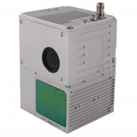
GS-100C+ LiDAR Scanning System Entry-Level 3D Data Collection Livox Avia Sensor
Geosun gAirHawk Sesries GS-100C+ LiDAR Scanning System
gAirHawk GS-100C+ is a kind of light compact LiDAR point
cloud data acquisition system, integrated Livox new generation
laser scanner, GNSS and IMU positioning and attitude determination
system, and storage control unit, is able to real-time,
dynamically, massively collect high-precision point cloud data and
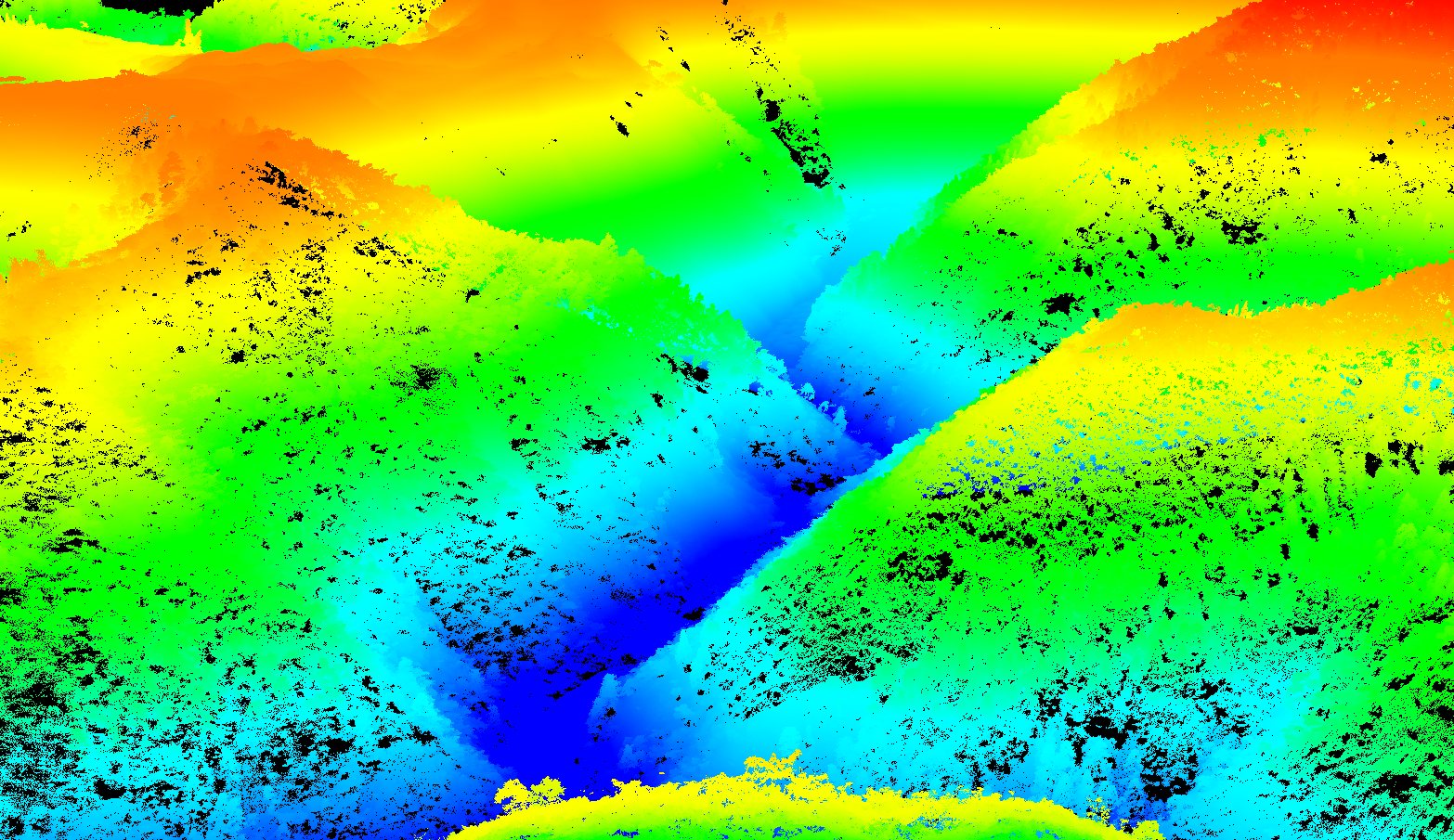
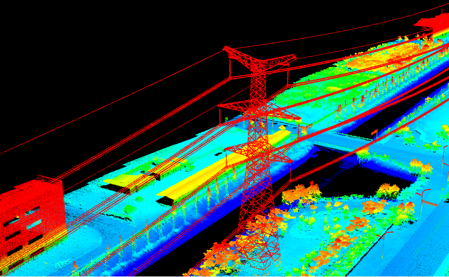
rich image information. It is widely used in the acquisition of 3D
spatial information in surveying, electricity, forestry,
agriculture, land planning.
Specification of LiDAR Scanning System gAirHawk GS-100C+
LiDAR Scanning System gAirHawk GS-100C+ | ||
| Item Name | System Parameter |
Parameter | Weight | 1015g |
Measuring accuracy | Less than 10cm (110 m AGL) | |
Power range | 12V~16V | |
Working temperature | -20℃~+55℃ | |
Consumption | Average 20W | |
Support Platform | Drone M300, M600 and GS-850 | |
Storage | 64GB storage, maximum support 128GB TF card | |
Lidar Unit
| Laser Model | Livox Avia |
Measuring Range | 190m@10% Reflectivity | |
Laser class | 905nm Class1 (IEC 60825-1:2014) | |
Laser line number | Equivalent to 64-beam | |
Range Precision | 2cm | |
data | Triple-echo, 720,000 Points/Sec | |
FOV | 70° the circular view | |
POS Unit | Update frequency | 200HZ |
Heading accuracy | 0.040° | |
Pitch accuracy | 0.015° | |
Rolling accuracy | 0.015° | |
Position accuracy | 0.02 - 0.05m | |
GNSS signal type | GPSL1/L2/L5 GLONASSL1/L2 BDS B1/B2/B3 GAL E1/E5a/5b | |
Pre-processing software | POS software | Output information: position, speed, attitude |
Point cloud software | Output point cloud data format: LAS format, custom TXT format | |
Built-in Camera | FOV | 83 Degree |
Effective Pixel | 26 Mega Pixel | |
Trigger event | Distance or Time trigger | |
Application of LiDAR Scanning System gAirHawk GS-100C+
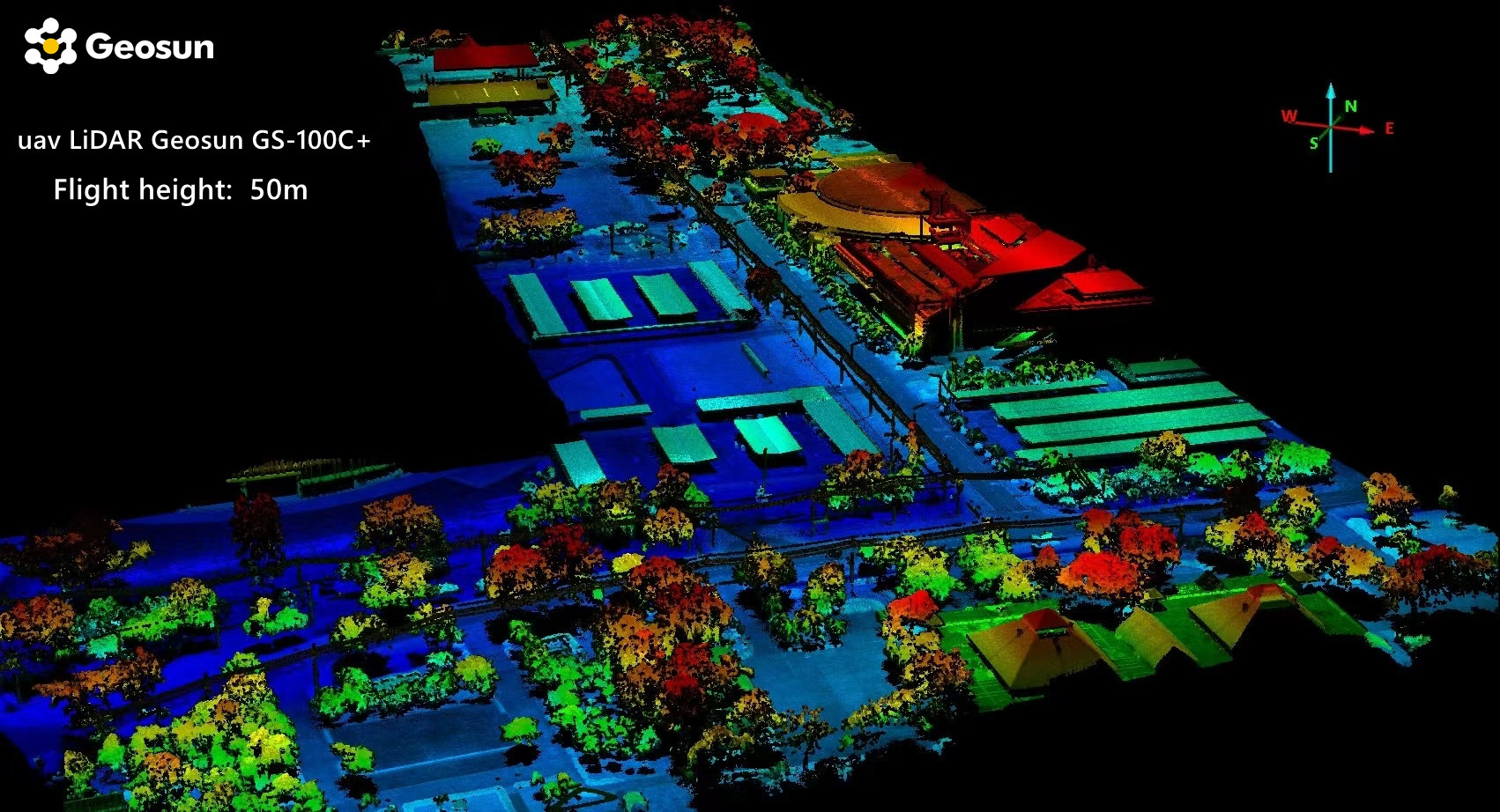
Free Trial Software LiDAR Scanning System gAirHawk GS-100C+
Free trial test, achieve high precision
The Guideline of LiDAR Usage and Reference.pdf
Point Cloud Pre-Processing Software Integrated With Trajectory
Processing----Geosun Self-developed gAirHawk 5.0
Key Features of gAirHawk 5.0 Software
1. Raw data: intelligently load
2. Four default coordinates
3. Point cloud Optimization
4. Start and stop calculation


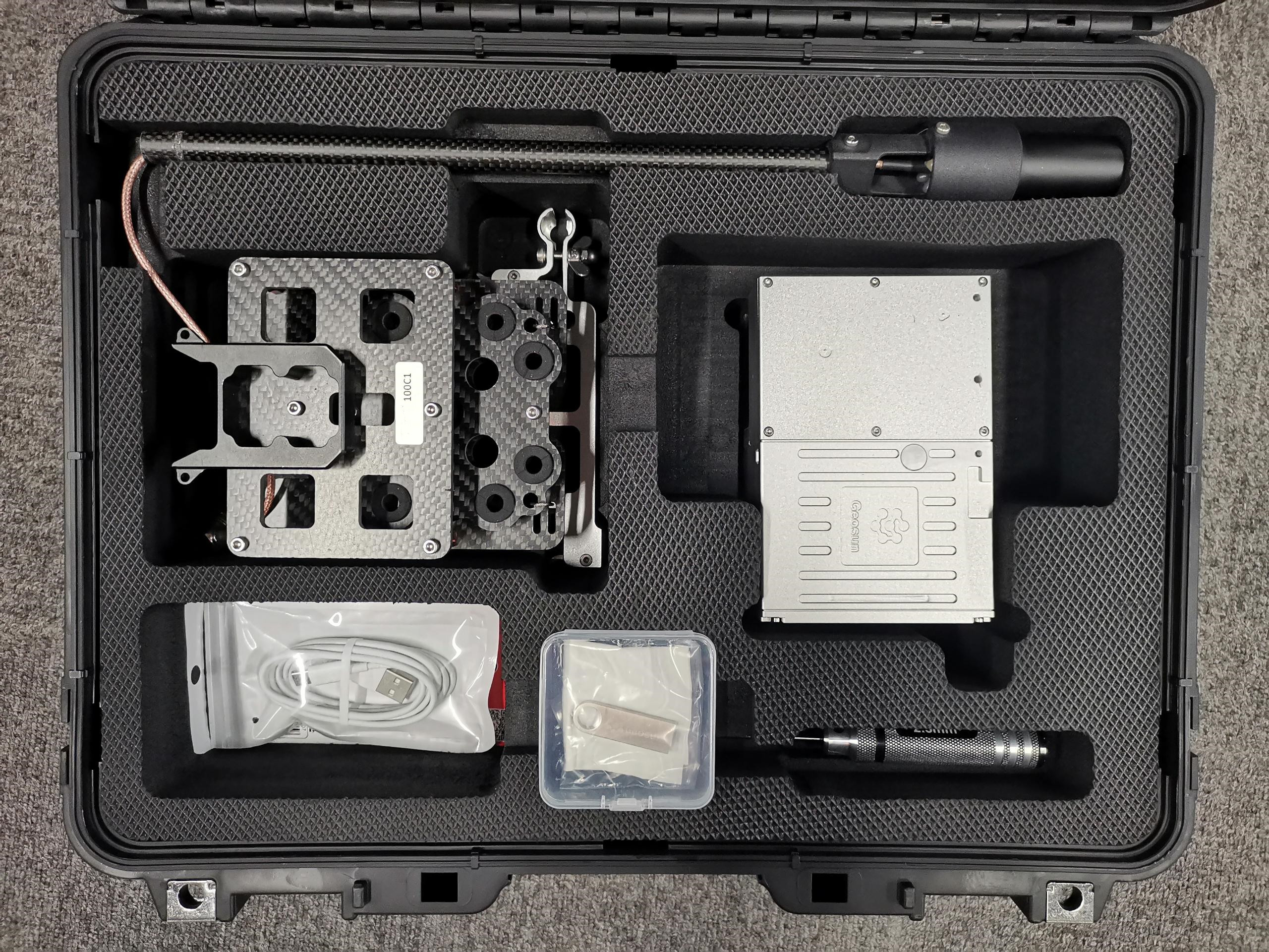
Package LiDAR Scanning System gAirHawk GS-100C+
LiDAR Scanning System gAirHawk GS-100C+ is packed by suit case with EVA material liner inside, then covered by hard carton box. It is suitable for air shipment and sea shipment.