Active Member
|
[China]

Address: No. 879, Ganghua Road, Hongguang Town, Pidu District, Chengdu
Contact name:admin

Chengdu Wanggan Technology Co., Ltd. |
|
|
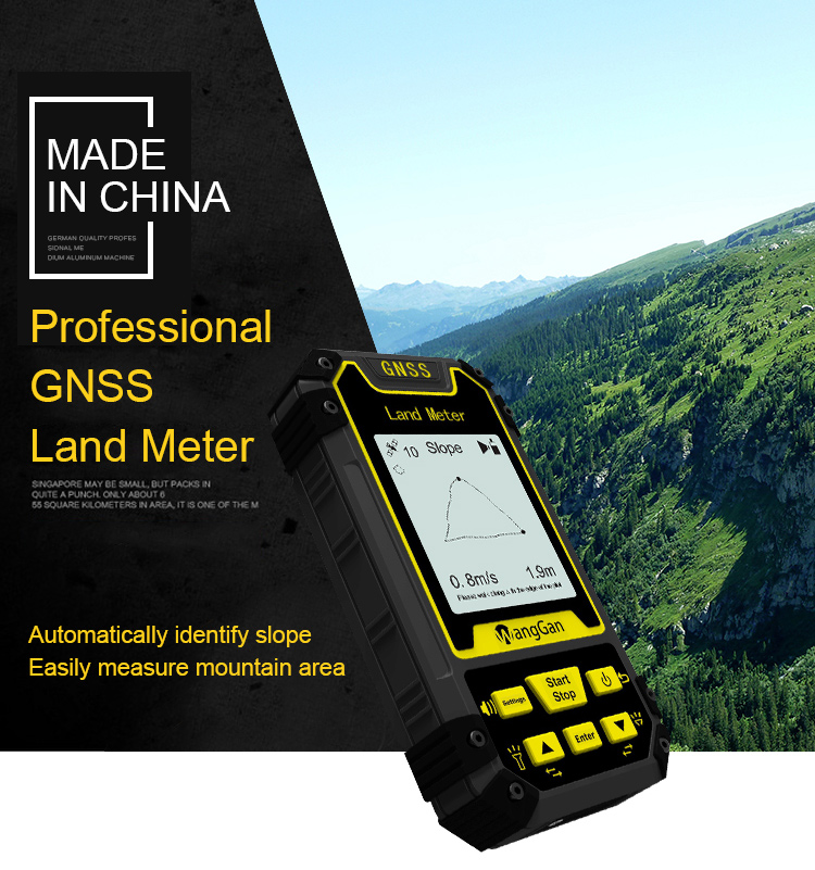
GPS Land Area Distance Survey Equipment GNSS GPS Survey Equipment
Technology parameter of handheld GPS survey equipment:
| Receiver chip | High sensitivity GPS receiver chip |
| Receiver antenna | Passive large-size planar antenna |
| Efficient startup | 1sec for warm boot, 30sec for cold boot. |
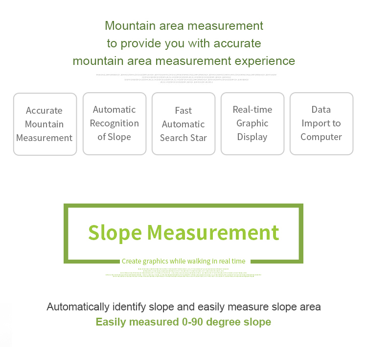
| Area accuracy | Measurement error within 0.03Mu(1-3Mu),2%(above 3Mu) |
| Distance accuracy | Within 1m(HDOP less than 1.0,measuring 100m in length) |
| Function characteristics | Longitude and latitude display,altitude display,area measurement,distance measurement,land price calculation |
| Data statistics | Area statistics,distance statistics |
| Area record | 99pieces |
| Distance record | 99pieces |
| Track display | The track will be displayed in real time in the course of measurement,it can also be viewed in statistical records. |
| Barometric leveling | About 1meter(Barometric measurement,the absolute altitude value needs to be calibrated) About 10meters(GPS measurement ,HDOP within 1.0) |
| HDOP setting | Custom HDOP setting |
| Screen display | 2.4 inch outdoor HD black-white |
| Prompt tone | Voice broadcast |
| Working temperature | -20°C~65°C |
| Storage temperature | -40°C~75°C |
| Equipment size | 117mm×61mm×22mm |
| Equipment weight | 120g(No battery) |
| Data interface | USB interface,it can be charged through this interface |
| Standard configuration | Host 1,lithium battery 1,charger 1,data line 1,lanyard 1,instruction 1,warranty card 1,packaging box 1. |
HDOP Setting Of Handheld GPS Survey Equipment:
① On the home page of boot,press the【Settings】button to enter the settings interface;
② Press the▲▼button move to “HDOP setting”;
③ Press the【Enter】button to enter;
④ Press the▲▼button to adjustment HDOP numerical value.
⑤ Press the【Enter】button to save and exit.
Note: Measurements can only be made if the value is lower than or equal to the set value.
Elevation calibration
① On the home page of boot,press the【Settings】button to enter the settings interface;
② Press the▲▼button to move to“Elevation calibration”;
③ Press the【Enter】button to enter;
④ Press the▲▼button to adjustment the number,and press the【Enter】button to complete the calibration.
⑤ Press the【Enter】button to save and exit.
Statistics record
① On the home page of boot,press the【Settings】button to enter the settings interface;
② Press the▲▼button move to“Statistics record”;
③ Press the【Enter】button to enter;
④ Press the▲▼button to move,select data statistics or measurement records;
⑤ Press the【Enter】button to enter,and view detailed records information.
⑥ Press the "Start" button to return.
Factory reset
① On the home page of boot,press the【Settings】button to enter the settings interface;
② Press the▲▼button move to“Factory reset”;
③ Select "Yes" and press【Enter】to restore the factory settings.
About This Mac
① On the home page of boot,press the【Settings】button to enter the settings interface;
② Press the▲▼button move to“About This MAC”;
③ Press the【Enter】button to view this machine software and hardware version and manufacturer information. Press the【Enter】button again,you can view the two-dimensional code of Wanggan WeChat Official Account.
View of current functions
① The text in the upper part of the main interface is the current function. If the upper blank indicates that the current function is the normal area measurement function.
② Press the【Enter】button to view current function in the main interface.
Mountain Mode Measurement:
at the mountain top, press [Start/Stop] button to start measuring the mountain area.Now, it is the point A; Reach to the bottom of the mountain, it
is the point B. Press the [enter] button to save point B information; then walk around the bottom of the mountain, press [enter] button when you
finished. press the [Start/Stop] button to pause the measurement data, [start] to go on and press the "power" button to end measurement and
save data.
Round-trip Machine Load :
In this mode, you could measure the area while the farm machine’s working. First, set the value number in Parameter Round-trip setting. Then
press [Start/Stop] button to start measuring while working. Press [Start/Stop] button to check when working is done. Press [Start] to go on when
it’s not finished. Press the "power" button to end measurement and save data.
Fixed point area measurement:
①In the main interface,press the ▲▼to switching function to“Fixed point”.
②At the land starting point,press the【Start】button to start measuring,and press the 【Enter】 button to confirm the information of the starting point.
③Walk along the edge of the land,press the 【Enter】button at each inflection point to collect the information of each inflection point;
④After collecting the information of the last inflection point (not coinciding with the starting point),press【Stop】button to pause the measurement and view the data.
⑤If the measurement is not completed,press the【Start】button again to continue the measurement. If the measurement is completed,press power button to save the data.
Note:
When using the fixed point function,two words of “fixed point ”will be displayed at the measurement interface.
When using the area measurement function,the measurement area icon will be displayed on the left side of the measurement interface.
When using the fixed width function,the words on the right side of the measurement interface represent the number of points collected.