

Active Member
|
[China]

Address: A105 1/F, New East Sun Industrial Building, 18 Shing Yip Street, Kwun Tong, Kowloon, HK.
Contact name:Bevan

HongKong GLK Industrial Co., Limited |
|
|
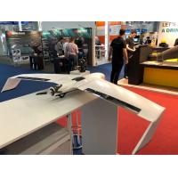
Mapping Surveying and Draw Fixed Wing Drone Easy to Control Automatically Calculate Flight Altitude And Routes
1. Smart Planning;Smart Take-Off;Smart Landing
2. One-man operation/Extraordinary endurance;No need of ground control points(The RTK Edition)
3. It's really safe,reliable and durable.Really cost-effective for consumers.
Raletive Accuracy:
Horizontal :1--3X GSD Vertical:1--5X GSD

Videos Shares
https://youtu.be/zsLWkecxQ0A


