Active Member
|
[China]

Address: No. 879, Ganghua Road, Hongguang Town, Pidu District, Chengdu
Contact name:admin

Chengdu Wanggan Technology Co., Ltd. |
|
|
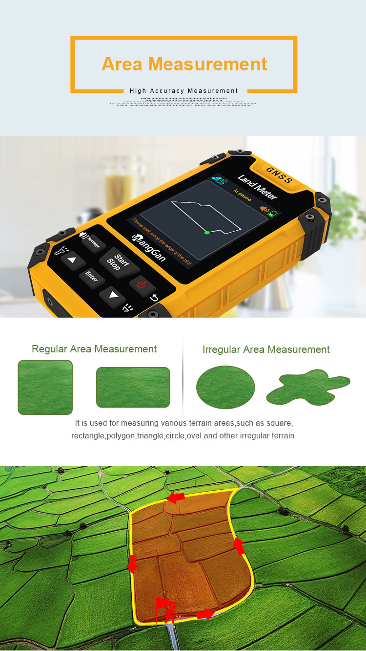
GPS GNSS Agriculture Geograph Land Survey Tool GPS Land Meter
1. There are lots of merits about S4 Wanggan land meter, such as Voice Broadcast, Easily Operate, Accurate Measurement and One Year Warranty
2. Built in barometer of this S4 land meter instrument, accurate to measure altitude. There is intelligent mountain area measurement mode in this
device. The combination of barometer and GPS dual satellite positioning makes the measurement of mountain area more accurate and easy.
3. Wanggan S4 land meter instrument is used in many kinds of situations and solve the problems of measuring acres for you.
4. This large color screen is clear and easy to read, this Wanggan S4 land meter instrument works well in the sun and at night, intuitive and
simple to operate.
5. This Wanggan S4 land meter instrument built in barometer and accurate to measure altitude.
6. Wanggan S4 land meter instrument is used for harvester, tractor, seeder, transplanter and other kinds of agricultural machinery measurement.
The machine load measurement automatically identifies the repeated area and does not calculate the area repeatedly.
On the vehicle measurement, applicable to all kinds of agricultural machinery.
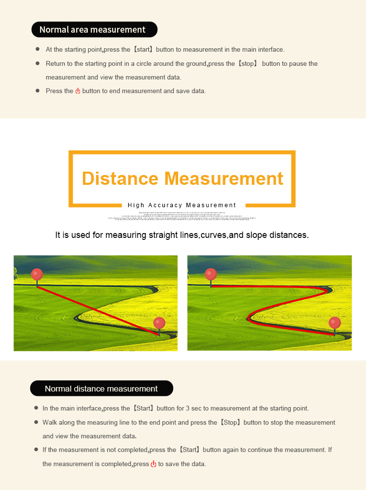
7. It doesn’t matter what the measurement is, regular or irregular, Wanggan S3 land meter instrument is used for measuring various terrain areas,
such as square, rectangle, polygon, triangle, circle, oval, and other irregular terrain. So you could do length and width area measurement, fixed
width area measurement, fixed point measurement and slope distance measurement.
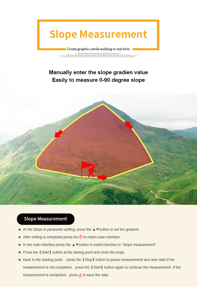
Slope Measurement:
1. At the Slope in parameter setting, press the [▲/▼] button to set the gradient.
2. After setting is completed,press the d to return main interface.
3. In the main interface,press the [▲/▼] button to switch function to "Slope measurement".
4. Press the [ Start] button at the staring point and circle the slope.
5. Back to the starting point, press the I Stop ] button to pause measurement and view data.If the measurement is not completed, press the [
Start] button again to continue the measurement.
6.If the measurement is completed, press power button to save the data