

Active Member
|
[China]

Address: No. 879, Ganghua Road, Hongguang Town, Pidu District, Chengdu
Contact name:admin

Chengdu Wanggan Technology Co., Ltd. |
|
|
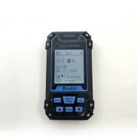
GPS Angriculture Ourdoor Land Field Measuring Exploration GPS Measuring Tool
The New Create and Management Function of Lofting Of GPS Measuring Tool
The lofting matches the route. New routes mean new lofting, and deleting routes means deleting lofting. So if you need to build new lofting points, you can build new routes, please refer to the method: New Route Function.
The Navigation Function of Lofting (Point-by-Point Navigation of Lofting Points)
1. In the home screen of the device, press the [Setting] button to enter the setting interface.
2. Please press the [▲][▼] button to move to "Route",and press the [Enter] button to enter.
3. Please Select "lofting Edit" and enter. After entering, press the [▲][▼] button to select the lofting route you need to navigate, and then press the [Enter] button to view the specific information of the selected route.
4. After confirming the navigation information, press the [Start/ Stop] button to start navigation.
5. During the navigation process, the pointer points to the navigation direction. When navigating to the lofting point, press the [Enter] button, then the navigation points to the next lofting point, and press the "Stop" button to exit navigation.
(When navigating to the lofting points one by one, the locator will display "Arrival Start Point", "Arrival Sample Point" and "Arrival End Point" in order)
6. Lofting Point: Hollow Point is the Point of Orientation
7. Pointer: The direction of the pointer is the direction of the navigation target point.


