

Active Member
|
[China]

Address: No. 879, Ganghua Road, Hongguang Town, Pidu District, Chengdu
Contact name:admin

Chengdu Wanggan Technology Co., Ltd. |
|
|
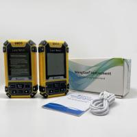
Handheld GPS Survey Equipment Portable Land Distance Area Measurement Tools
Measurement of Handheld GPS Survey Equipment:
1. In an open area outside ,press the "power" button for 2 seconds to enter into the home surface of the land meter;
2. Search satellite after start up,there will be voice prompt,the text on the screen indicates the status of the signal and the value of HDOP. It is recommended that the HDOP value below 1.0 start measuring.
3. After the HDOP value is below 1.0 ,press the▲▼button to choose measurement function,and start to measure according to the demand.At last,press the【Start/Stop】button to the measurement surface.
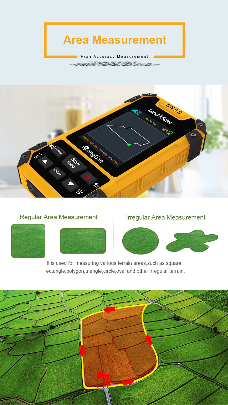
Normal area measurement,L/W area measurement
Using range:all flat terrain
1. At the starting point(Start at any point),press the【Start/Stop】button to measure in the main surface;
2. Return to the starting point in a circle around the ground,press the【stop】 button to pause the measurement and view the measurement
data.
3. Press the "power" button to end measurement and save data.
Using range:The measured terrain should be a regular rectangle
①At the starting point A,press the【Start/Stop】button to measure,and press the【Enter】button to save point A information;
②Going from point A to point B,press the【Enter】button to save point B information ;Then going from point B to point C,press the【Enter】
button to save point C information ;At last,press the【Start/Stop】button to view the measurement data;
③Press the "power" button to end measurement and save data.
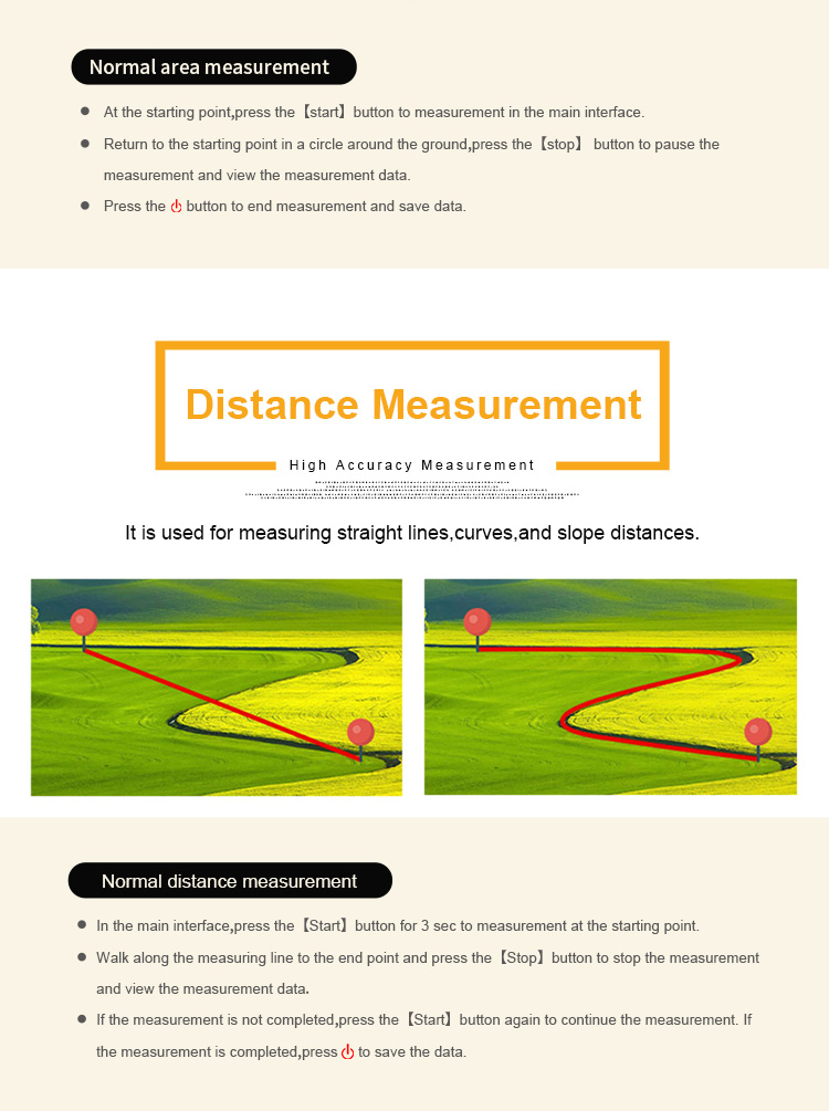
Normal distance measurement
Using range:all flat terrain
①At the starting point(Start at any point),press the【Start/Stop】button for 3 seconds to measure in the main surface;Press the【Start/Stop】
button at the ending point and end the measurement to view the measurement data;
②Press the "power" button to end measurement and save data.


| Functions | S4 |
| Positioning accuracy | 2.5m |
| Initial barometric calibration | √ |
| Normal area measurement | √ |
| Mountain area measurement | √ |
| Intell. Slope measurement | √ |
| Fixed point measurement | √ |
| Fixed width area measurement | √ |
| Normal distance measurement | √ |
| Manual distance measurement | √ |
| Altitude display | √ |
| Altitude measurement | √ |
| Track display | √ |
| Mu setting | √ |
| Unit setting | √ |
| Time display | √ |
| Data statistics | √ |
| Historical record | √ |
| Lighting /Currency detection | √ |
| Dry battery | √ |
| lithium battery | √ |
| Data storage | 200 |
| Voice broadcast | √ |
| Data export | √ |


