

Active Member
|
[China]

Address: No. 879, Ganghua Road, Hongguang Town, Pidu District, Chengdu
Contact name:admin

Chengdu Wanggan Technology Co., Ltd. |
|
|
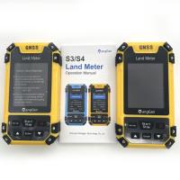
GLONASS GPS Land Measurement GPS Machine , S4 Survey Grade GPS Equipment
Product Features Of Survey Grade Handheld GPS:
| Receiver chip | High sensitivity GNSS receiver chip |
| Receiver antenna | Passive large-size planar antenna |
| Efficient startup | 1sec for warm boot, 30sec for cold boot. |
| Area accuracy | Measurement error within 0.03Mu(1-3Mu),2%(above 3Mu) |
| Distance accuracy | Within 1m(HDOP less than 1.0,measuring 100m in length) |
| Function characteristics | Longitude and latitude display,altitude display,area measurement,distance measurement,land price calculation |
| Data statistics | Area statistics,distance statistics |
| Area record | 200pieces |
| Distance record | 200pieces |
| Track display | The track will be displayed in real time in the course of measurement,it can also be viewed in statistical records. |
| Barometric leveling | About 1meter(Barometric measurement,the absolute altitude value needs to be calibrated) About 10meters(GPS measurement ,HDOP within 1.0) |
| HDOP setting | Custom HDOP setting |
| Screen display | Color screen(320*240) |
| Prompt tone | Voice broadcast |
| Working temperature | -20℃~65℃ |
| Storage temperature | -40℃~75℃ |
| Equipment size | 117mm×61mm×20mm |
| Equipment weight | 120g(No battery) |
| Data interface | USB interface,it can be charged through this interface |
| Standard configuration | Host 1,lithium battery 1,charger 1,data line 1,lanyard 1,instruction 1,warranty card 1,packaging box 1. |
Product function introduction of survey grade handheld GPS:
| Model Functions | S3 | S4 |
| Positioning accuracy | 2.5m | 2.5m |
| Initial barometric calibration | × | √ |
| Normal area measurement | √ | √ |
| Mountain area measurement | × | √ |
| Intell. Slope measurement | × | √ |
| Fixed point measurement | √ | √ |
| Fixed width area measurement | √ | √ |
| Normal distance measurement | √ | √ |
| Manual distance measurement | √ | √ |
| Altitude display | √ | √ |
| Altitude measurement | √ | √ |
| Track display | √ | √ |
| Mu setting | √ | √ |
| Unit setting | √ | √ |
| Time display | √ | √ |
| Data statistics | √ | √ |
| Historical record | √ | √ |
| Lighting /Currency detection | √ | √ |
| Dry battery | √ | √ |
| lithium battery | √ | √ |
| Data storage | 200 | 200 |
| Voice broadcast | √ | √ |
| Data export | × | √ |
Mountain Mode Measurement:
at the mountain top, press [Start/Stop] button to start measuring the mountain area.Now, it is the point A; Reach to the bottom of the mountain, it is the point B. Press the [enter] button to save point B information; then walk around the bottom of the mountain, press [enter] button when you finished. press the [Start/Stop] button to pause the measurement data, [start] to go on and press the "power" button to end measurement and save data.
Round-trip Machine Load :
In this mode, you could measure the area while the farm machine’s working. First, set the value number in Parameter Round-trip setting. Then press [Start/Stop] button to start measuring while working. Press [Start/Stop] button to check when working is done. Press [Start] to go on when it’s not finished. Press the "power" button to end measurement and save data.
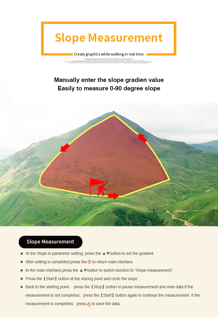
Intell Slope : at the starting point, press [Start/Stop] button to measure in the main surface; walk around the slope and press the [Start/Stop] button when you finished. Press the [Start/Stop] button to pause the measurement. Press the "power" button to end measurement and save data.
L/W mode : at the starting point , press the [Start/Stop] button to measure,and press the [enter] button to save information; Going from point to another point, press the [enter] button to save information; then going from this point to the finial point, press the [enter] button to save information; at last, press the [Start/Stop] button to view the measurement data; press the "power" button to end measurement and save data.
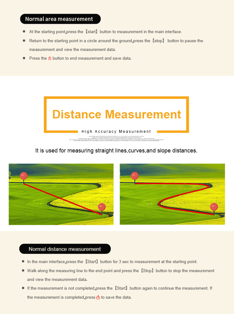
Normal distance mode: at the starting point, press [Start/Stop] button to start measuring ;Walk along the measuring line to the
end point and press the [Stop] button to stop the measurement and view the measurement data;If the measurement is not
completed,press the[Start]button again to continue the measurement. If the measurement is completed,press "power" button
to save the data.
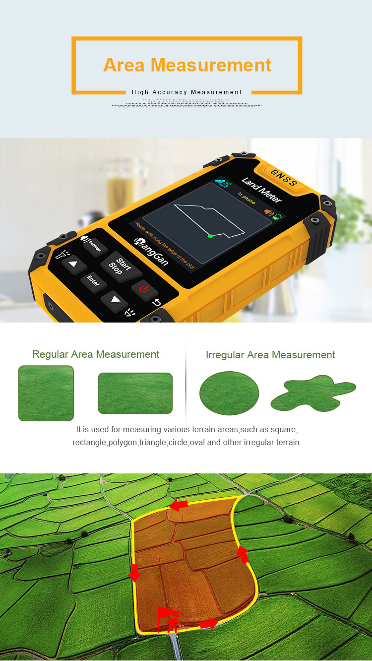
Normal mode : at the starting point, press [Start/Stop] button to measure in the main surface; return to the starting point in a
circle around the ground, press the [Start/Stop] button to pause the measurement data. Press the "power" button to end
measurement and save data.
Shutdown:
Press the button for about 2 secs and the shutdown page appears, press the [enter] button to confirm the shutdown.


| Functions | S4 |
| Positioning accuracy | 2.5m |
| Initial barometric calibration | √ |
| Normal area measurement | √ |
| Mountain area measurement | √ |
| Intell. Slope measurement | √ |
| Fixed point measurement | √ |
| Fixed width area measurement | √ |
| Normal distance measurement | √ |
| Manual distance measurement | √ |
| Altitude display | √ |
| Altitude measurement | √ |
| Track display | √ |
| Mu setting | √ |
| Unit setting | √ |
| Time display | √ |
| Data statistics | √ |
| Historical record | √ |
| Lighting /Currency detection | √ |
| Dry battery | √ |
| lithium battery | √ |
| Data storage | 200 |
| Voice broadcast | √ |
| Data export | √ |


