|
|
[China]

Trade Verify
Address: 4F, Building D, Tianyi plaza No.8 West Maodianshan Road, East Lake Hi-tech Zone Wuhan City, China
Contact name:Lanbooxie

Wuhan Geosun Navigation Technology Co., Ltd |
|
Verified Suppliers
|
|
|
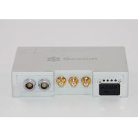
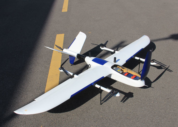
Photography Surveying PPK Solution Aerial GNSS Receiver
Features of PPK Solution
Lightweight and flexible aviation GNSS positioning receiver
GGPos GNSS dynamic data processing software
Reduce more than 80% of the control point
High work efficiency
Enhance the safety of the field
Specification of PPK Solution
| Tracking Signal | GPS: L1 C/A code, L2 C, L1 / L2 ; |
| BDS:B1, B2a, B3 | |
| Galileo: E1,E5B | |
| GLONASS: L1 C/A and P code, L1 /L2 , L2 P code | |
| Processor | STM32F407 |
| Build-in RAM | 8 GB Byte EMMC |
| Build-in flash | 8 GB data flash; 1 GB nand flash |
| SD card storage | Max support up to 32 GB |
| Update rate | Default update rate 20 Hz |
| Storage format | Geosun format |
| Indicator : | 2 LED indicators, same function, indicate GNSS signal and power |
| PW/EVENT/PPS/RS232 | One lemon 9 pin interface, use for power input, data input/output and communication with PC |
| Antenna interface | One external antenna interface |
| Mini usb interface | One mini USB port |
| Micro SD card slot | One micro SD card slot |
| Power consumption (w) | 3.2 |
| Dimension (mm) | 66 * 60 * 17 |
| Working Circumstance | Working temperature :- 20 ºC-- 60 ºC |
| Storage temperature: - 40ºC-- 80 ºC |
Application for Photography

Kinematic differential Positioning