
|
|
[China]

Trade Verify
Address: 4F, Building D, Tianyi plaza No.8 West Maodianshan Road, East Lake Hi-tech Zone Wuhan City, China
Contact name:Lanbooxie

Wuhan Geosun Navigation Technology Co., Ltd |
|
Verified Suppliers
|
|
|
Long Distance 650M Uav Lidar Mapping Real Time High Accuracy
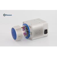
The RIEGL VUX-1UAV
Uav Lidar is a very lightweight and compact laser scanner,
meeting the challenges of emerging survey solutions by UAS/UAV/RPAS
both in measurement performance as well as in system integration.
With regard to the specific constraints and flight characteristics
of the UAS, the RIEGL VUX-1UAV is designed to be mounted in any
orientation and even under limited weight and space conditions.
Modest in power consumption, the instrument requires only a single
power supply. The entire data set of an acquisition campaign is
stored onto an internal 240 GByte SSD and/or provided as real-time
line scan data via the integrated LAN-TCP/IP interface.
The RIEGL VUX-1UAV provides highspeed data acquisition using a
narrow infrared laser beam and a fast line scanning mechanism.
High-accuracy laser ranging is based on RIEGL's unique echo
digitization and online waveform processing, which enables
achieving superior measurement results even under adverse
atmospheric conditions, and the evaluation of multiple target
echoes. The scanning mechanism is based on an extremely fast
rotating mirror, which provides fully linear, unidirectional and
parallel scan lines, resulting in excellent regular point pattern.
Feature of Uav Lidar
10 mm survey-grade accuracy
scan speed up to 200 scans / second
measurement rate up to 500,000 meas./sec
(@ 550 kHz PRR & 330° FOV)
operating flight altitude more than 1,000 ft
field of view up to 330° for practically unrestricted data
acquisition
regular point pattern, perfectly parallel scan lines
cutting edge RIEGL technology providing
LAN-TCP/IP interface
scan data storage on internal 1TByte SSD Memory
Specification
| gAirHawk GS-1350 | ||
| Item Name | System Parameters | |
Parameters | Weight | 4.5 kg (without camera) |
| Measuring accuracy | 0.1m/0.05m(@150m) | |
| Working temperature | -20℃~+60℃ | |
| Power range | 12 V- 24 V | |
| Consumption | 65 W | |
| Carrying Platform | M600 PRO | |
| Storage | 64 GB storage, maximum support 128GB TF card | |
Lidar Unit
| Measuring Range | 550m@20% Reflectivity, 1350m@60% Reflectivity, |
| Laser class | 905nm Class1 (IEC 60825-1:2014) | |
| Laser line number | Single-Beam | |
| Max. range | 1350 m | |
| Mix. range | 3 m | |
| Range accuracy | 10 mm, average 5 mm | |
| Scanning frequency | 10HZ-200HZ | |
| data | 550,000 Points/Sec | |
| FOV | 360°, adjustable | |
| Laser sensor | Riegl laser sensor | |
| POS Unit | Update frequency | 200HZ |
| Heading accuracy | 0.010° | |
| Pitch accuracy | 0.003° | |
| Rolling accuracy | 0.003° | |
| Position accuracy | Horizontal: 0.01m, Vertical: 0.02m | |
| GNSS signal type | GPSL1/L2/L5 GLONASSL1/L2 BDS B1/B2/B3 GAL E1/E5a/5b | |
| IMU | AGS 314 | |
| Pre-processing software | POS software | Output information: position, speed, attitude |
| Point cloud software | Output point cloud data format: LAS format, custom TXT format | |
| Camera (option) | Camera Model | Sony a 6000 or other brand with same level |
| Effective Pixel | 24 Mega Pixel | |
| Trigger event | Distance or Time trigger | |
| Weight (g) | Less than 136 | |
Application for Terrain Survey
Package
It is packed by suit case with EVA material liner inside, then
covered by hard carton box. It is suitable for air shipment and sea
shipment.


