
|
|
[China]

Trade Verify
Address: 4F, Building D, Tianyi plaza No.8 West Maodianshan Road, East Lake Hi-tech Zone Wuhan City, China
Contact name:Lanbooxie

Wuhan Geosun Navigation Technology Co., Ltd |
|
Verified Suppliers
|

|
|
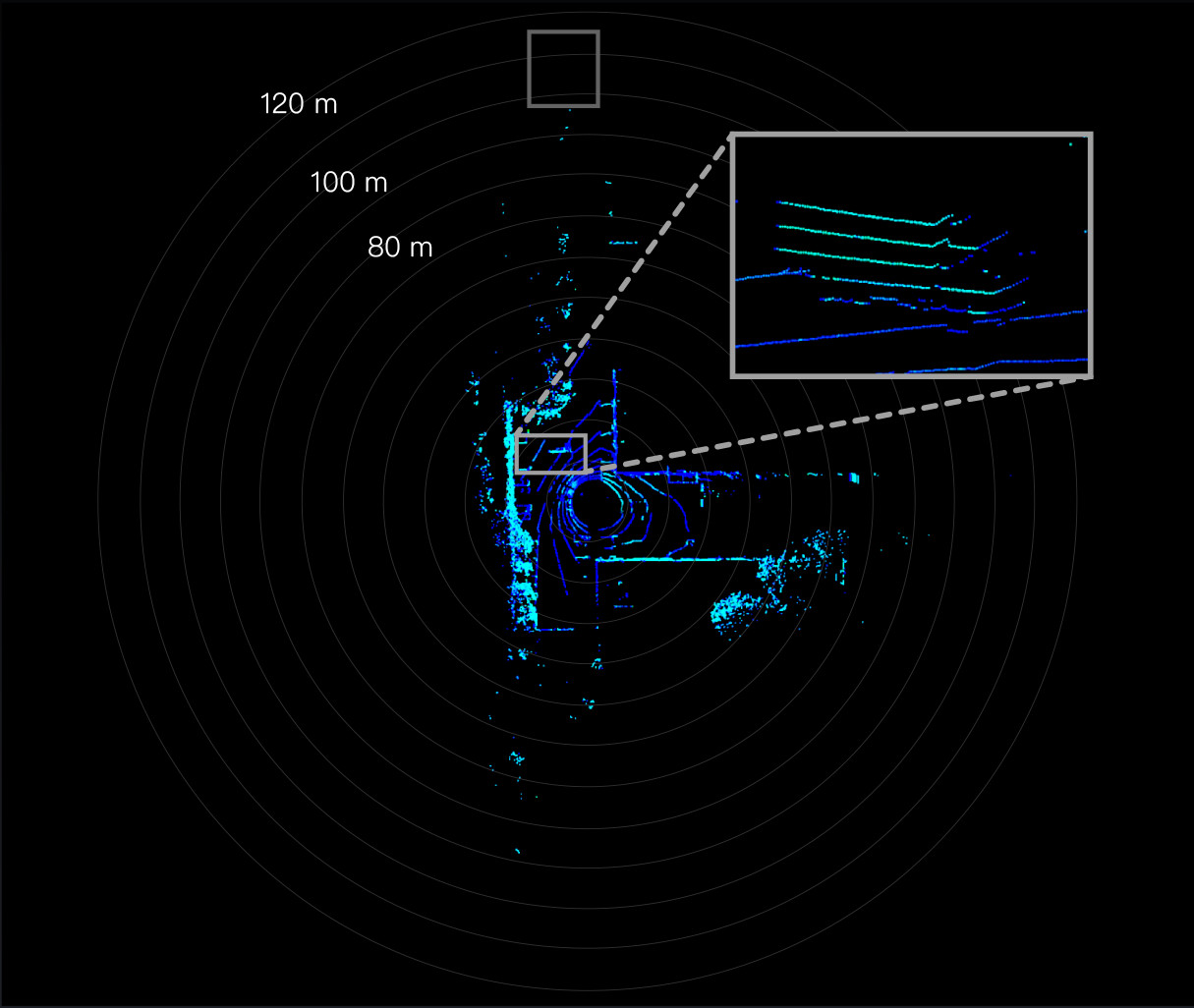
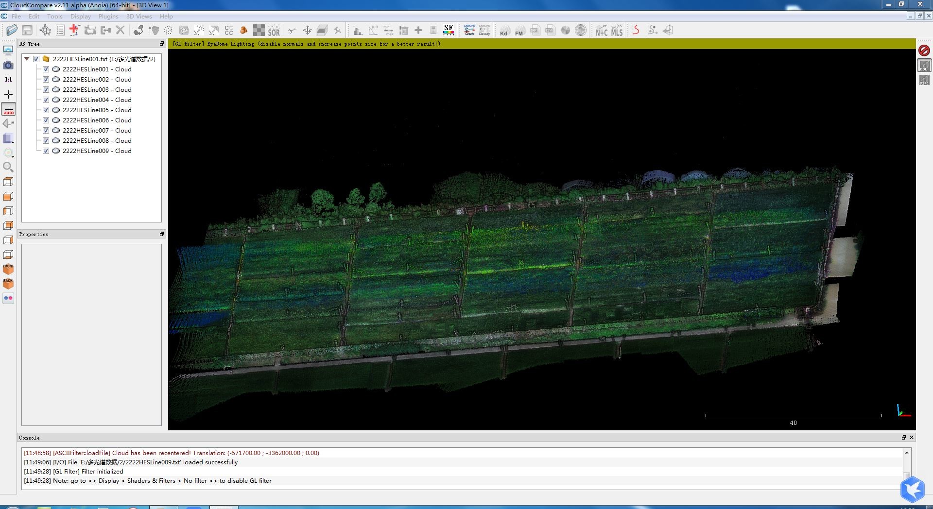
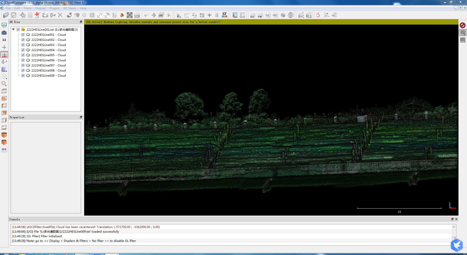
Compact Multispectral Camera LiDAR Scanning System For Forestry
gAirHawk GS-130D is a kind of short-range, compact LiDAR point cloud data acquisition system, integrated HESAI XT laser scanner, GNSS and IMU positioning and attitude determination system, and storage control unit, is able to real-time, dynamically, massively collect high-precision point cloud data and rich image information. It is widely used in the acquisition of 3D spatial information in forestry, agriculture.
Pandar XT
High precision. Minimum range of zero.
Proprietary LiDAR ASICs.
32-Channel Short-Range Mechanical LiDAR
Specification
| |||||||||||||||||||||||||||||||||||||||||||||||||||||||||||||||
Application for Forestry & Agriculture
Package
It is packed by suit case with EVA material liner inside, then covered by hard carton box. It is suitable for air shipment and sea shipment.


