Home Companies Wuhan Geosun Navigation Technology Co., Ltd

3D LiDAR Data Processing Software With Color PT File Output

Wuhan Geosun Navigation Technology Co., Ltd

Contact Us

[China] country

Trade Verify

Address: 4F, Building D, Tianyi plaza No.8 West Maodianshan Road, East Lake Hi-tech Zone Wuhan City, China

Contact name:Lanbooxie

Inquir Now

Wuhan Geosun Navigation Technology Co., Ltd

Verified Suppliers
  • Trust
    Seal
  • Verified
    Supplier
  • Credit
    Check
  • Capability
    Assessment

3D LiDAR Data Processing Software With Color PT File Output

Country/Region china
City & Province wuhan hubei
Categories Other Consumer Electronics
InquireNow

Product Details

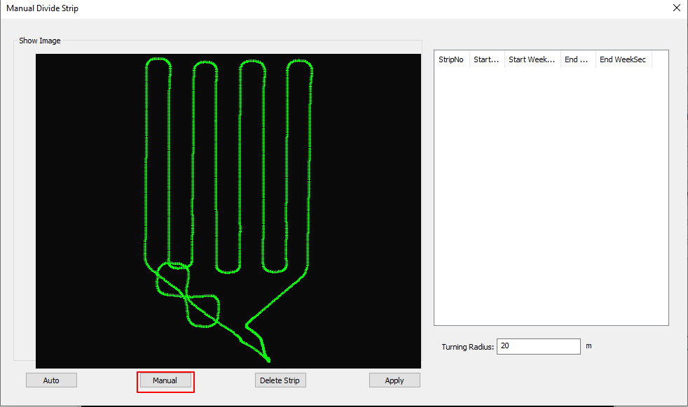
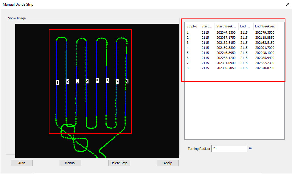
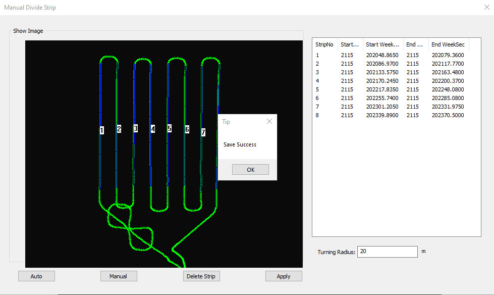
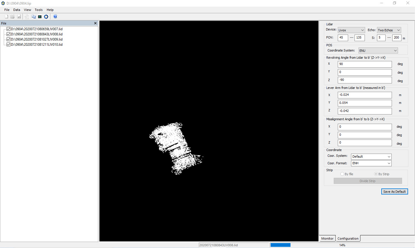
                                                                                           gAirHawk Introduction

3D LiDAR Data Processing Software With Color PT File Output
gAirHawk is a lidar scanning system acquisition monitoring and point cloud computing software self-developed by Geosun Navigation. It supports real-time configuration and monitoring of field data acquisition systems, decoding of real-time and post-process laser scanning data, calculation and display of point cloud data, supporting software for Geosun lidar scanning system.


The Interface of gAirhawk
The Operation of 4 8 Version of gAirhawk Software - YouTube


Creat New Project and Operation
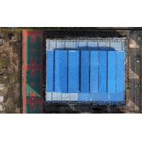
 

Divided by Strip


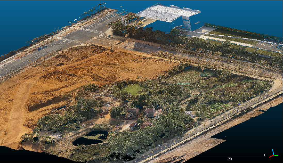
Lidar data process and point clouds output


Color point clouds


The links of 4.9 version of gAirhawk software as following
https://drive.google.com/drive/folders/1DDFwpx4XEZd_yVVhYXvPK8TUXru0eNqH?usp=sharing


Hot Products

GS-260F LiDAR Scanning System HESAI Pandar 40P Versatile Application RTK Model Power Line Geosun ...
GS-100M+ LiDAR System Livox Avia Laser Entry-Level 3D Data Collection Mapping Surveying Geosun ...
LiDAR Scanning System GS-100V HESAI XT16 Laser Sensor Built-In Camera High Precision Aerial Scan ...
GS-100C LiDAR Scanning System Skyport DJI M300 Livox Avia Sensor Colored Point Cloud Geosun gAirHawk ...
Geosun GS-260X UAV LiDAR Aerial Mapping Drone Surveying City Construction 3D Modeling Geosun ...
GS-2000N LiDAR Scanning System 7 Echos Long Detection Aerial VTOL Mapping High Accuracy Geosun ...