|
|
[China]

Trade Verify
Address: Building 19, East Dist. R&D Center,#27 Yangqiaohu Ave.,Jiangxia Dist.,Wuhan,Hubei,China
Contact name:lfang

Wuhan Hi-Cloud Technology Co.,Ltd |
|
Verified Suppliers
|

|
|
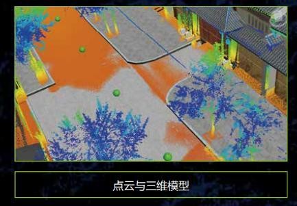
420m@80% range 5mm@30m accuracy HiScan-R Lightweight Mobile LiDAR
System with 0.001° angular resolution
HiScan-R lightweight mobile LiDAR system is mobile surveying
and mapping equipment based on Riegl LiDAR and launched
by Wuhan Hi-Cloud Technology Co., Ltd. It integrates modules
like 2D laser scanning equipment (LS), satellite positioning
module (GNSS), inertial navigation unit (IMU), wheel encoders,
panoramic cameras, assembly control module and high-performance
board computer, etc.. It can collect point cloud data and panoramic
images in real-time. It is convenient to install in various
carriers such as cars, beach buggies, ships or other mobile
carriers. The production and processing of vector map data, street
view data and geographic data can be easily completed during the
movement of the carriers. It is widely used in topographic survey,
urban municipal component survey, urban garden survey, traffic
survey and design, traffic information survey, street view map
service, digital city, waterway and island survey and other fields.
Specification
HiScan-R Lightweight Mobile LiDAR System
| Items | Parameters |
| Number of Scanners | 1 |
| Range Measurement | 420m@80% reflectivity |
| Laser Frequency | Max. 1,000,000points/s |
| Range Accuracy | 5mm@30m |
| Angular Resolution | 0.001° |
| Panoramic Camera | 30M pixels |
| Accuracy | 5cm@100m |
| Scan Speed | 10-250 scans/s |
| Positioning Accuracy (no lock loss, post-processing) | horizontal 0.01m |
| vertical 0.02m | |
| Orientation Accuracy (no lock loss, post-processing) | heading 0.004° |
| pitch/roll 0.003° |
Features
Application Fields
It can be widely used in street view maps, cadastral surveys, urban
municipal component surveys, traffic survey informatization, urban
landscaping surveys, digital/smart 3D city, digital waterways,
island and reef survey and other fields.
i. Internet street view map
ii. Basic topographic mapping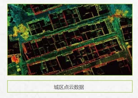
iii. Urban municipal component survey
iv. Urban landscaping survey


v. Highway survey and intelligent transportation


vi. Digital 3D city