Active Member
|
[China]

Address: No. 879, Ganghua Road, Hongguang Town, Pidu District, Chengdu
Contact name:admin

Chengdu Wanggan Technology Co., Ltd. |

|
|
Mountain GPS Instrument For Land Survey S2 GPS Land Survey Equipment
Product Parameters Of Model S2 GPS Land Survey Equipment :
| Machine model |
S2 | |||
| Normal area measurement | √ | |||
| Fixed area measurement | √ | |||
Machine load area measurement
| √ | |||
| Slope area measurement | √ | |||
| Intell. Slope measurement | √ | |||
| Fixed point measurement | √ | |||
| L/W area measurement | √ | |||
| Mountain area measurement | √ | |||
| Normal distance measurement | √ | |||
| Multipoint distance measurement | √ | |||
| Slope distance measurement | √ | |||
| Altitude display | √ | |||
| Altitude measurement | √ | |||
| Track display | √ | |||
| Real-time track | √ | |||
| Mu setting | √ | |||
| Unit setting | √ | |||
| Time display | √ | |||
| Data statistics | √ | |||
| Historical record | √ | |||
| Data export | √ | |||
| Car charger | √ | |||
| Lighting /Currency detection | √ | |||
| Voice broadcast | √ | |||
| Protection level | IP66 |
Machine Operation Methods:
HDOP setting of GPS land meter:
①On the home page of boot,press the【Settings】button to enter the settings interface;
②Press the▲▼button move to “HDOP setting”;
③Press the【Enter】button to enter;
④Press the▲▼button to adjustment HDOP numerical value.
⑤Press the【Enter】button to save and exit.
Note: Measurements can only be made if the value is lower than or equal to the set value.
Elevation calibration of GPS land meter:
①On the home page of boot,press the【Settings】button to enter the settings interface;
②Press the▲▼button to move to“Elevation calibration”;
③Press the【Enter】button to enter;
④Press the▲▼button to adjustment the number,and press the【Enter】button to complete the calibration.
⑤Press the【Enter】button to save and exit.
Statistics record of GPS land meter:
①On the home page of boot,press the【Settings】button to enter the settings interface;
②Press the▲▼button move to“Statistics record”;
③Press the【Enter】button to enter;
④Press the▲▼button to move,select data statistics or measurement records;
⑤Press the【Enter】button to enter,and view detailed records information.
⑥Press the "power" button to return.
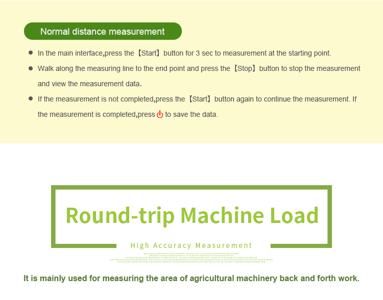
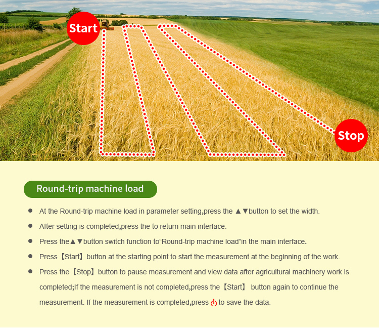
Fixed width of GPS land meter:
①At the Fixed width in parameter setting, press the ▲▼button to set the width.
②After setting is completed,press the "power" button to return main interface.
③Press the▲▼button switch function to “Fixed width”in the main interface;press the【Start】button to measure in starting point;Press【Stop】button to pause measurement when measuring to the bottom line and view data;If the measurement is not completed, press the【Start】button again to continue the measurement. If the measurement is completed,press "power" button to save the data.