|
|
[China]

Trade Verify
Address: 4F, Building D, Tianyi plaza No.8 West Maodianshan Road, East Lake Hi-tech Zone Wuhan City, China
Contact name:Lanbooxie

Wuhan Geosun Navigation Technology Co., Ltd |
|
Verified Suppliers
|
|
|
Land Surveying Vtol LiDAR Long Detection Geosun gAirHawk GS-2000N
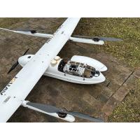
Geosun gAirHawk Series uav LiDAR Scanning System GS-2000N
UAV LiDAR Scanning System gAirHawk GS-2000N is a kind of long range, compact LiDAR point cloud data acquisition system, integrated MT-1500H long range laser scanner, GNSS and IMU positioning and attitude determination system, and storage control unit, is able to real-time, dynamically, massively collect high-precision point cloud data and rich image information. It is widely used in the acquisition of 3D spatial information in surveying, electricity, forestry, agriculture, land planning.
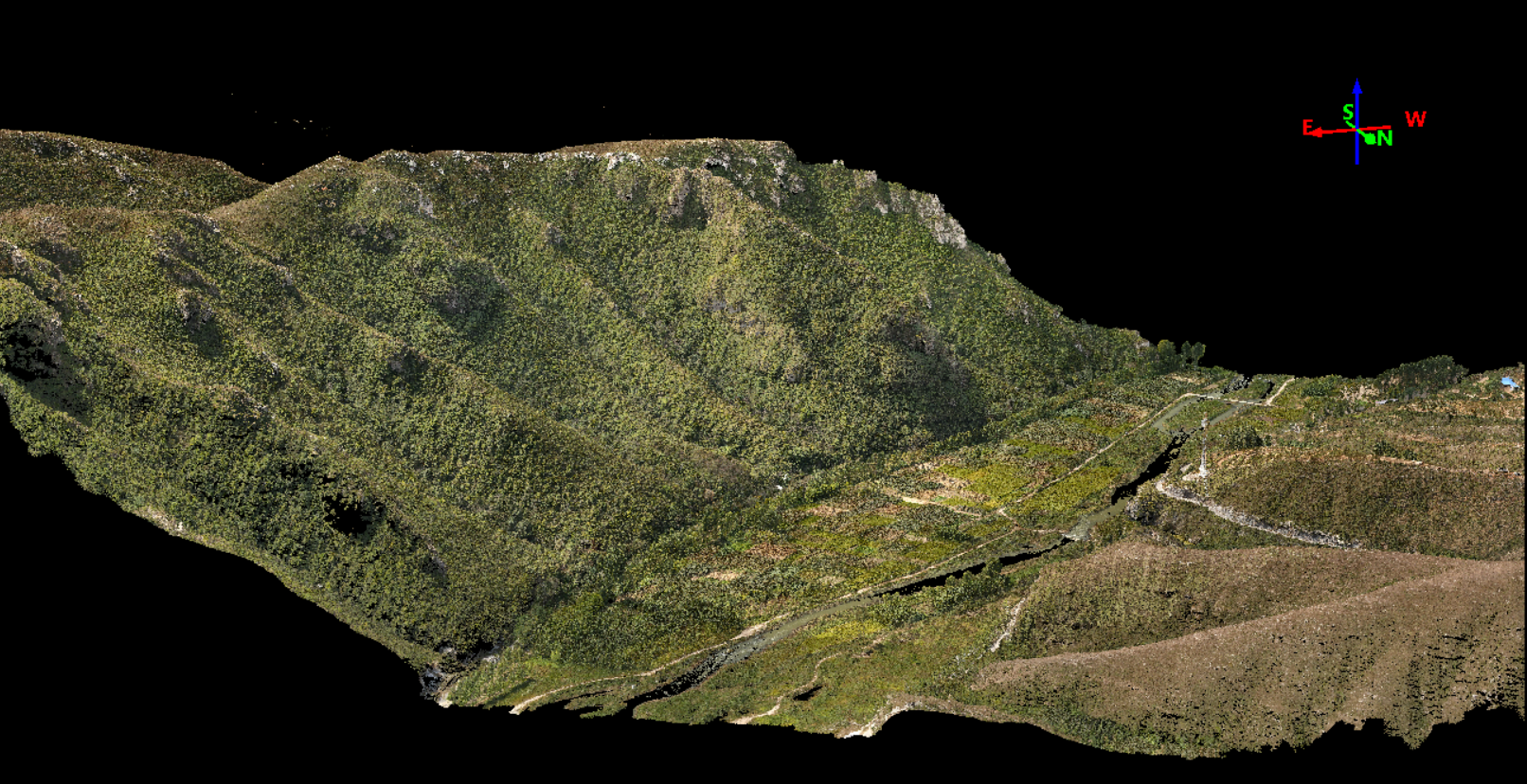
Application of UAV LiDAR Scanning System
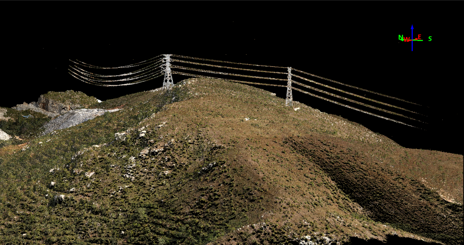
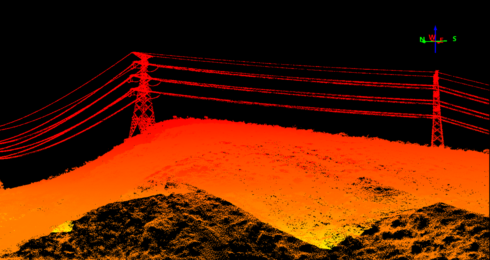
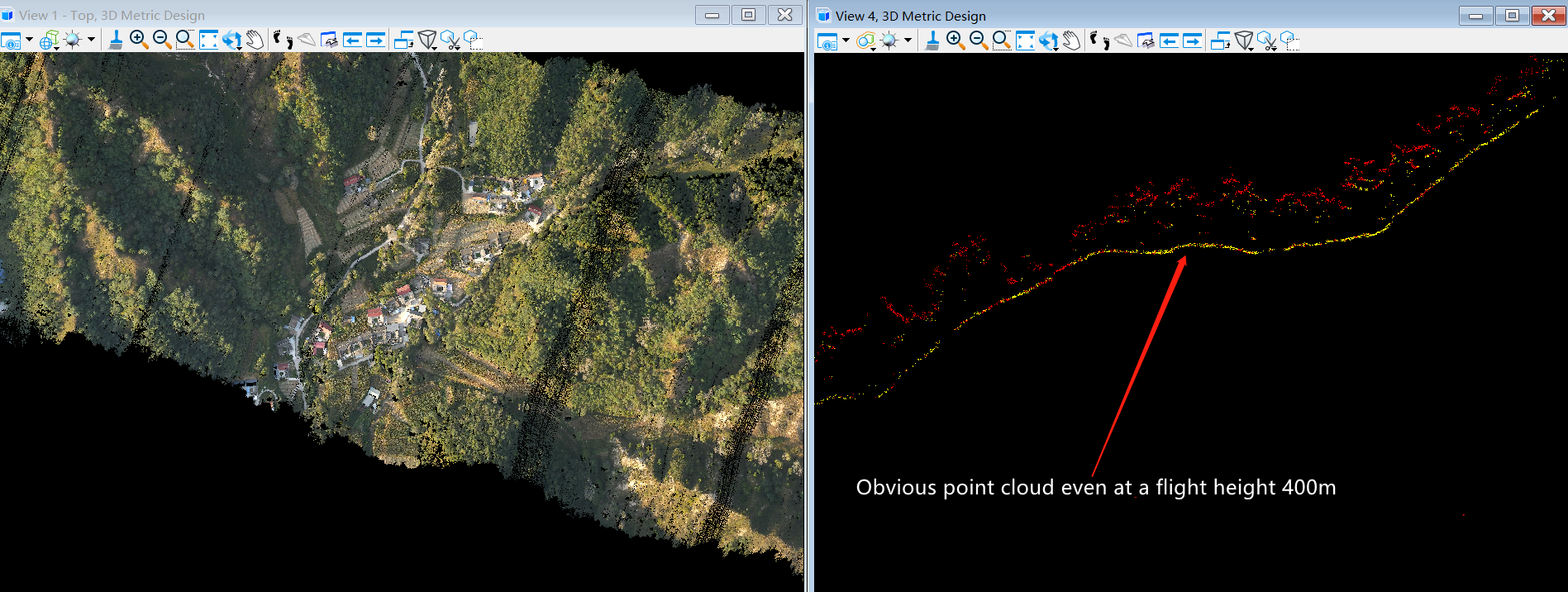
A set of high-quality data collected by GS-2000N LiDAR scanning system in a continuous hills area at a flight height 400m. uav LiDAR scanning system delivers an absolute accuracy down to 8cm at a 300 meters flight altitude and provides clear and completed ground points despite the high-density primitive vegetation covering. Geosun GS-2000N LiDAR scanning system is always your reliable partner to capture the geospatial information for the most challenging environments.


Free Trial Software uav LiDAR Scanning System
Free trial test, achieve high precision
The Guideline of LiDAR Usage and Reference.pdf
Point Cloud Pre-Processing Software Integrated With Trajectory
Processing----Geosun Self-developed gAirHawk 5.0
Key Features of gAirHawk 5.0 Software
1. Raw data: intelligently load
2. Four default coordinates
3. Point cloud Optimization
4. Start and stop calculation
Specification of uav LiDAR Scanning System GS-2000N
uav LiDAR scanning system gAirHawk GS-2000N | ||
| Item Name | System Parameters |
Parameters | Weight | 3.2kg |
Working temperature | -20℃~+60℃ | |
Power range | 12 V- 24 V | |
Consumption | 65 W | |
Carrying Platform | 6 Aixs Multi Rotor Drone | |
Storage | 64 GB storage, maximum support 128GB TF card | |
Lidar Unit
| Measuring Range | 2000m@80% |
Laser class | 1550nm Class1 (IEC 60825-1:2014) | |
Laser line number | FT-1500H Single-Beam | |
Measuring accuracy | 3mm@100m | |
Max. range | 2000m | |
Return | Seven echos | |
Pulse frequency | 50HZ-2000HZ | |
Beam Divergence | 0.3mrad | |
FOV | 75°-90°, adjustable | |
POS Unit | Update frequency | 200HZ |
Heading accuracy | 0.010° | |
Pitch accuracy | 0.003° | |
Rolling accuracy | 0.003° | |
Position accuracy | Horizontal: 0.01m, Vertical: 0.02m | |
GNSS signal type | GPSL1/L2/L5 GLONASSL1/L2 BDS B1/B2/B3 GAL E1/E5a/5b | |
IMU | gSpin 410 | |
Pre-processing software | POS software | Output information: position, speed, attitude |
Point cloud software | Output point cloud data format: LAS format, custom TXT format | |
Camera (built-in) | FOV | 48*33 Degree |
Effective Pixel | 45 MP (Full Frame Camera) | |
focal Length(mm) | 16 | |
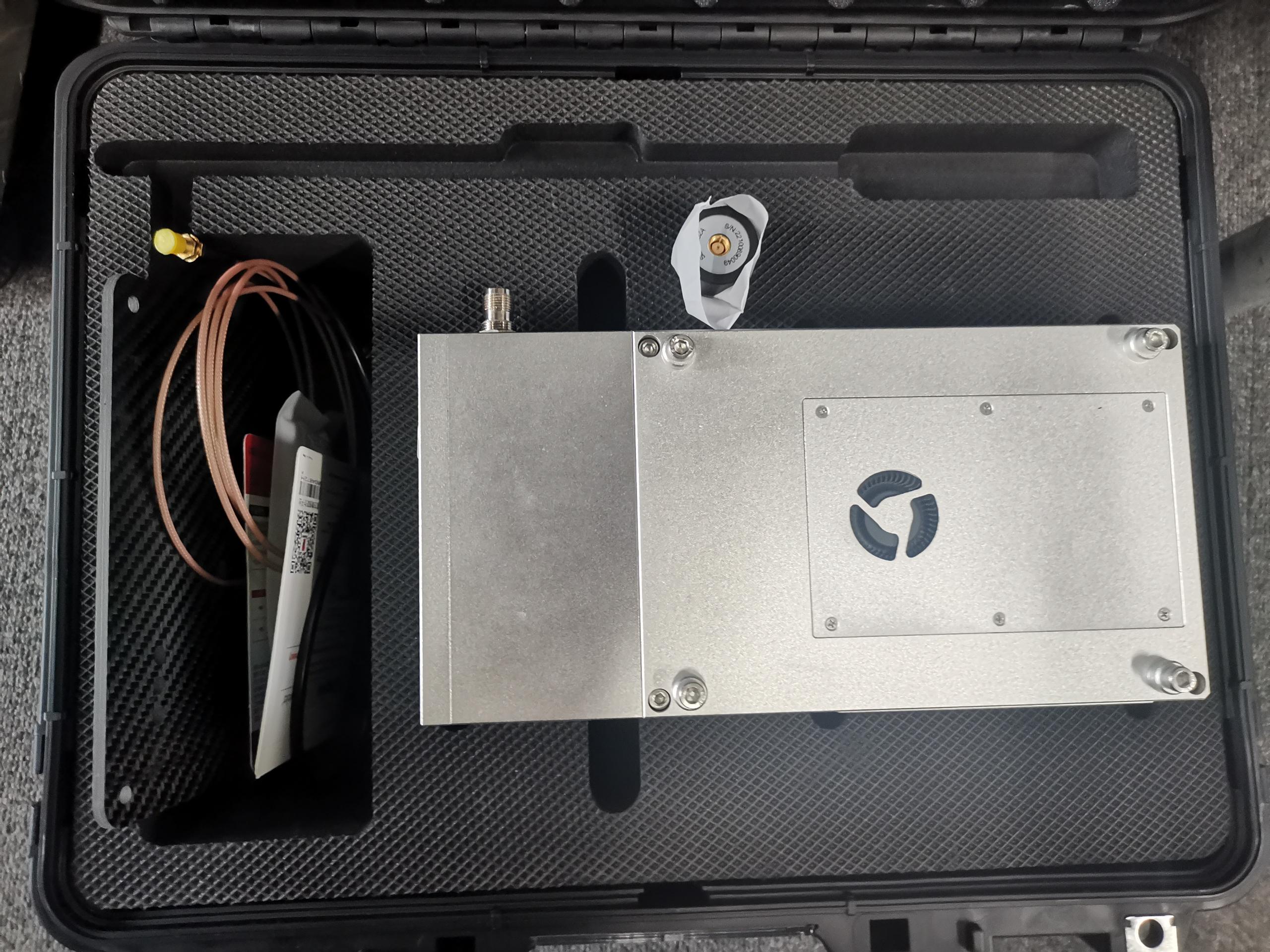
Package of uav LiDAR Scanning System GS-2000N
UAV LiDAR Scanning System is packed by suit case with EVA material liner inside, then covered by hard carton box.
The pacakge of uav LiDAR scanning system is suitable for air shipment and sea shipment.