
|
|
[China]

Trade Verify
Address: Room 1118, Block B, 11th Floor, No.68 Tonghe Road, Xixing Street, Binjiang District, Hangzhou City, Zhejiang Province
Contact name:Jianyu Qiu

Hangzhou Blue Aspirations Technology Co., Ltd. |
|
Verified Suppliers
|
|
|
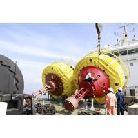
LAN Data Transmission Floating LiDAR System for Wind Farm Layout Optimization
The Floating LiDAR System is a comprehensive data collection system designed to provide sub-real-time data with accuracy and reliability. Its measurement capabilities include a 5m width and 1Hz scanning frequency. It also has a wide range of data transmission methods such as 4G, Wifi, LAN, and USB, with data output in subreal-time and data format in TXT/CSV/Log. This floating laser detection system is suitable for large-scale applications, with its highly accurate and reliable data collection performance.
| Product Name | Technical Parameters |
|---|---|
| BA-FLS-NX5 | Airborne Laser Rangefinder System |
| Laser Scanner Detection System | |
| Width: 5m | |
| Height: 9m | |
| Accuracy: ±2cm | |
| Data Format: TXT/CSV/Log | |
| Data Storage: 900GB | |
| Operating Temperature: -30℃~50℃ | |
| Scanning Frequency: 1Hz | |
| Scanning Range: 360° | |
| Data Output: Subreal-time |
This Floating LiDAR System (FLS) from Blue Aspirations has been developed for aerial light detection and ranging applications. It can provide high-precision range measurements of up to 9 meters in height. Its scanning frequency of 1Hz and data storage capacity of 900GB make it an ideal choice for monitoring a wide range of environments. The BA-FLS-NX5 is certified for use in China and requires a minimum order quantity of 1. A DC 24V power supply powers this device and is available for purchase for 1,500,000.
The Blue Aspirations BA-FLS-NX5 Floating LiDAR System is a reliable and efficient tool for wind turbine inspection, autonomous navigation, infrastructure monitoring, and powerline mapping applications. It can scan large areas quickly and accurately, making it a valuable asset for surveying, mapping, and other related applications.
Blue Aspirations BA-FLS-NX5 Airborne Laser Rangefinder System is a Light Detection and Ranging System (LiDAR) that can measure distances and map terrain. It is a high-performance system that features a 9m height and 5m width, a scanning frequency of 1Hz, and has a lifespan of 10 years.
Floating LiDAR System offers comprehensive technical support and service.
We provide our customers with timely and professional technical assistance and services, including:
We strive to ensure that our customers have the best experience with our products, and we are committed to providing the highest quality of service.
Our Floating LiDAR System is packed securely to ensure safe delivery. The system is enclosed in a robust cardboard box and surrounded by packing material to protect against shock. We use a reliable third-party courier service to ship the Floating LiDAR System to its destination.


