

Active Member
|
[China]

Contact name:Ben

HX DRONE Technology Co., LTD |

|
|
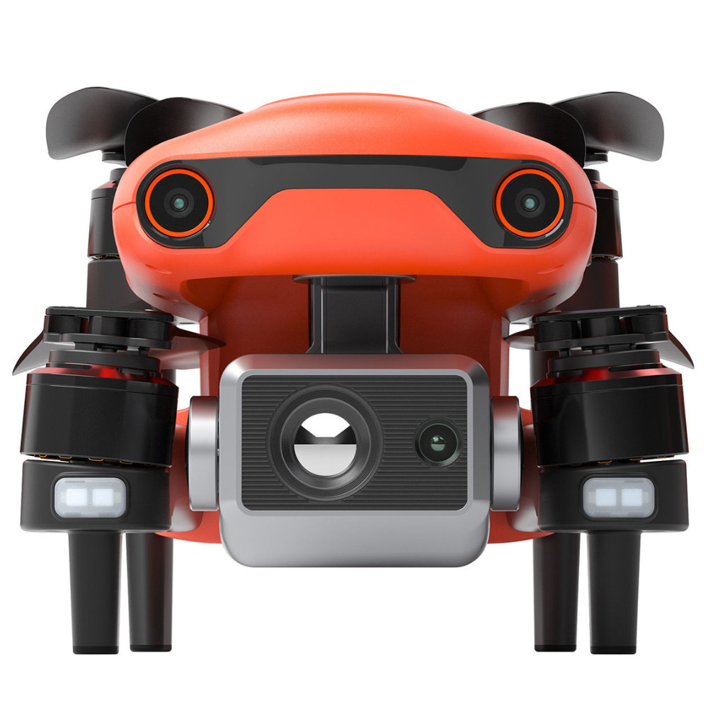
HX640TV3 640X512 Thermal HD Penta-Eye Camera 8K Surveillance Long Range UAV Engineering Urban Aerial Mapping Drone
33 Minutes Hover
HX640TV3 not only advanced features like obstacle avoidance and
intelligent flight modes, but also high-tech muscle that brings
home a top speed of 45mph, 33-minute hover time, 38-minute flight
time and an operating distance of 5.6 miles.
8K/25 fps Shooting Speed
HX640TV3 has a radiometric thermal sensor and it’s stabilized
3-axis camera allows you to shoot at up to 8K/25 fps, and view the
live feed at up to 1080p on your mobile device or the remote
control’s built-in OLED screen.
Powerful Telephoto Zoom
Resolutions up to 640x512 enable EVO II 640T pilots to capture
subjects with great detail from up to 100 meters - 4x farther than
any aircraft of its class. The 30Hz refresh rate produces smooth
dynamic thermal movement by matching me thermal images to video
rate
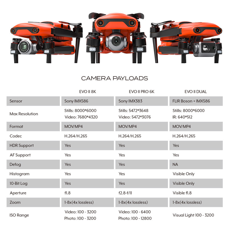
| Aerial Mapping Drone Specifications | |
| Infrared Thermal Imaging Sensor | Uncooled infrared |
| Sensor Resolution | 640x512 |
| Photo Resolution | Infrared mode: 640* 512 PIP: 1920*1080, 1280*720 |
| Video Format | MOV / MP4 (Support H.264/H.265) |
| Video Resolution | 640* 51230fps |
| Accurate Temperature Measurement Distance | 2-20meters |
| Pixel Size | 12um |
| Wavelength Range | 8~14um |
| Focal Length | 13mm |
| Angle Of View | H33°V26° |
| Zoom | 1X-16X |
| Photo Shooting Mode | Single shooting, continuous shooting, timed shooting |
| Temperature Range | High Gain Mode: 20° to +150° Low gain mode: 0° to +550° |
| Temperature Measurement Accuracy | ±3°C or ±3% of reading (whichever is greater) @ambient temperature 20°C~60°C |


Purchasing FAQ?
1. How can you ship Aerial Mapping Drone to my country?
We cooperate closely with DHL, FEDEX, UPS and other international express companies, which can reach almost all places in the world. International express usually only takes 3~7 days.
2. Do I need to pay import duties?
We have a DDP logistics solution, that is, we will help you pay your country's import duties in advance, and then you can sign for the goods directly after they pass the customs.
3.Do you offer warranty?
Yes, we can provide free repair or spare parts replacement in case of product quality problem within 1 year
4. Does it provide technical services?
Yes, all products provide free technical guidance, and provide installation instructions video &PDF.
5.How Can I get this products?
We can send by DHL to door directly or by air /sea for big order.
6. Can I get samples first?
YES, welcome to take sample to test with a little fee.


