|
|
[China]

Trade Verify
Address: No. 166 of Wenyuan Road,Jianggan District,Hangzhou City, Zhejiang Province, China
Contact name:Winnie Luo

Hangzhou CHNSpec Technology Co., Ltd. |
|
Verified Suppliers
|
|
|
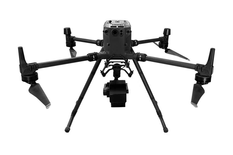

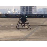
| Size | Dimensions (expanded, excluding blades) : 810 x 670 x 430 mm (L x W x H) |
| Dimensions (folded, including blades) : 430 x 420 x 430 mm (L x W x H) | |
| Symmetrical motor wheelbase | 895 mm |
| Weight (including lower | Air weight (without battery) : 3.6kg |
| single head bracket) | Air weight (including dual batteries) : 6.3kg |
| Maximum load of single gimbal damping ball | 930g |
| Maximum takeoff weight | 9 kg |
| Working frequency | 2.4000-2.4835 GHz 5.725-5.850 GHz |
| Transmit power (EIRP) | 2.4000-2.4835 GHz: |
| 29.5 dBm(FCC);18.5dBm(CE)18.5 dBm(SRRC);18.5dBm(MIC) | |
| 5.725-5.850 GHz:28.5 dBm(FCC);12.5dBm(CE)28.5 dBm(SRRC) | |
| Hover accuracy (P-GPS) | Vertical: ± 0.1m (when visual positioning works normally) ± 0.5m (when GPS works normally) |
| ± 0.1m (when RTK positioning works normally) | |
| Level: ± 0.3m (when visual positioning works normally) ± 1.5m (when GPS works normally) | |
| ± 0.1m (when RTK positioning works normally) | |
| RTK position accuracy | RTK FIX: 1 cm+1 ppm (horizontal) 1.5 cm+1 ppm (vertical) |
| Maximum angular velocity of rotation | Pitch axis: 300°/s Heading axis: 100°/s |
| Maximum pitch angle | 30° (P mode with forward-vision system enabled: 25°) |
| Maximum rate of rise | S mode: 6 m/s,P mode: 5 m/s |
| Maximum velocity of descent (vertical) | S mode: 5 m/s,P mode: 4 m/s |
| Maximum sloping descent rate | S mode: 7 m/s |
| Maximum horizontal flight speed | S mode: 23 m/s,P mode: 17 m/s |
| Maximum flight altitude | 5000 m (2110 blade, takeoff weight ≤7 kg) / 7000 m (2195 plateau quiet blade, takeoff weight ≤7 kg) |
| Maximum wind speed tolerance | 15m/s (12m/s during takeoff and landing) |
| Maximum flight time | 55 min |
| Supports the gimbal installation mode | Single holder set at the bottom, single holder set at the top, double holder set at the bottom, single holder set |
| at the bottom + single holder set at the top, double holder set at the bottom + single holder set at the top | |
| IP protection level | IP45 |
| GNSS | GPS+GLONASS+BeiDou+Galileo |
| Operating ambient temperature | -20°C to 50°C |
| Lighting system | Passive lighting (without light source) |
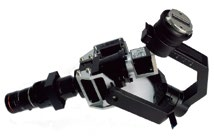
| Spectroscopic methods | Grating |
| Spectral range | 400-1000nm |
| Spectral band | 1200 |
| Resolution of spectrum | 2.5nm |
| Slit width | 25um |
| Transmission efficiency | >60% |
| Stray light | <0.5% |
| Number of spatial pixels | Maximum 1920 (software configurable) |
| Pixel size | 5.86um |
| Imaging speed | Full band 128Hz, 3300Hz can be achieved after ROI |
| Detector | CMOS |
| SNR(Peak) | 600/1 |
| The camera output | USB3.0 or Gigabit network |
| The camera interface | C-Mount |
| Accessories | USB3.0 transmission line or Gigabit network transmission line |
| ROI | Multiple regions |
| Embedded data acquisition and processing storage unit | I7 processor 512GSSD storage |