Active Member
|
[China]

Address: No. 879, Ganghua Road, Hongguang Town, Pidu District, Chengdu
Contact name:admin

Chengdu Wanggan Technology Co., Ltd. |
|
|
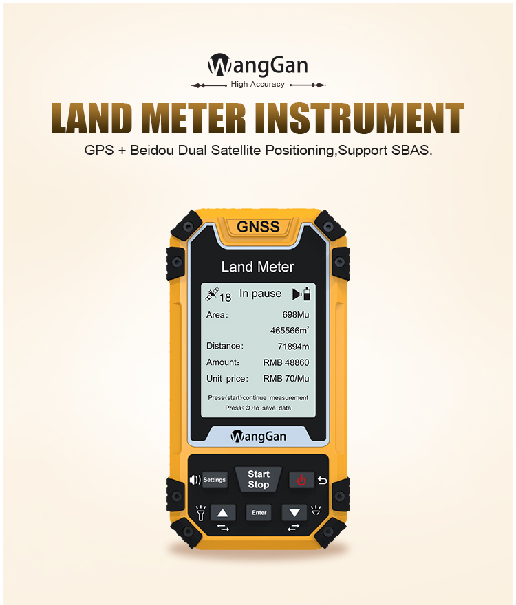
2.4 Inch GPS Land Surveying Equipment , Voice Broadcast Land Survey GPS Devices
Technology parameter:
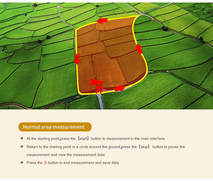
Operation methods of GPS land measuring instrument:
1. Normal mode : at the starting point, press [Start/Stop] button to measure in the main surface; return to the starting point in a circle around the
ground, press the [Start/Stop] button to pause the measurement data. Press the "power" button to end measurement and save data.
2. L/W mode : at the starting point A, press the [Start/Stop] button to measure,and press the [enter] button to save point A information; Going from
point A to point B, press the [enter] button to save point B information; then going from point B to point C, press the [enter] button to save point
C information; at last, press the [Start/Stop] button to view the measurement data; press the "power" button to end measurement and save
data.
3. Turn off the machine:
Press the button for about 2 secs and the shutdown page appears, press the [enter] button to confirm the shutdown.
Setting methods of GPS land measuring instrument:
1. unit setting:
Press the up and down button to adjust the requirement value, set number and unit, press [enter] button to the next.step. Press "power" button to
save the data.
2. System setting:
Press the up and down button to adjust the requirement value, set number and unit., press [enter] button to the next.
3. Data record:
(1) Data statistics:
Press [enter] button to delete and "power" button to return.
(2) Measuring record:
Press the [Setting] button to view graphic,[enter] button to delete and the up and down button to move, power button to return.
4. Time zone choose:
Choose the time zone of your area and press the [Enter] button to select.
5. Factory reset:
Restore the factory setting, Yes or No? The [Enter] button is Yes and "power" button is No.