
|
|
[China]

Trade Verify
Address: 4F, Building D, Tianyi plaza No.8 West Maodianshan Road, East Lake Hi-tech Zone Wuhan City, China
Contact name:Lanbooxie

Wuhan Geosun Navigation Technology Co., Ltd |
|
Verified Suppliers
|
|
|
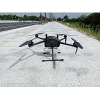
Multi Rotor LiDAR Drone Safety Aircraft Aerial Survey Operation Support
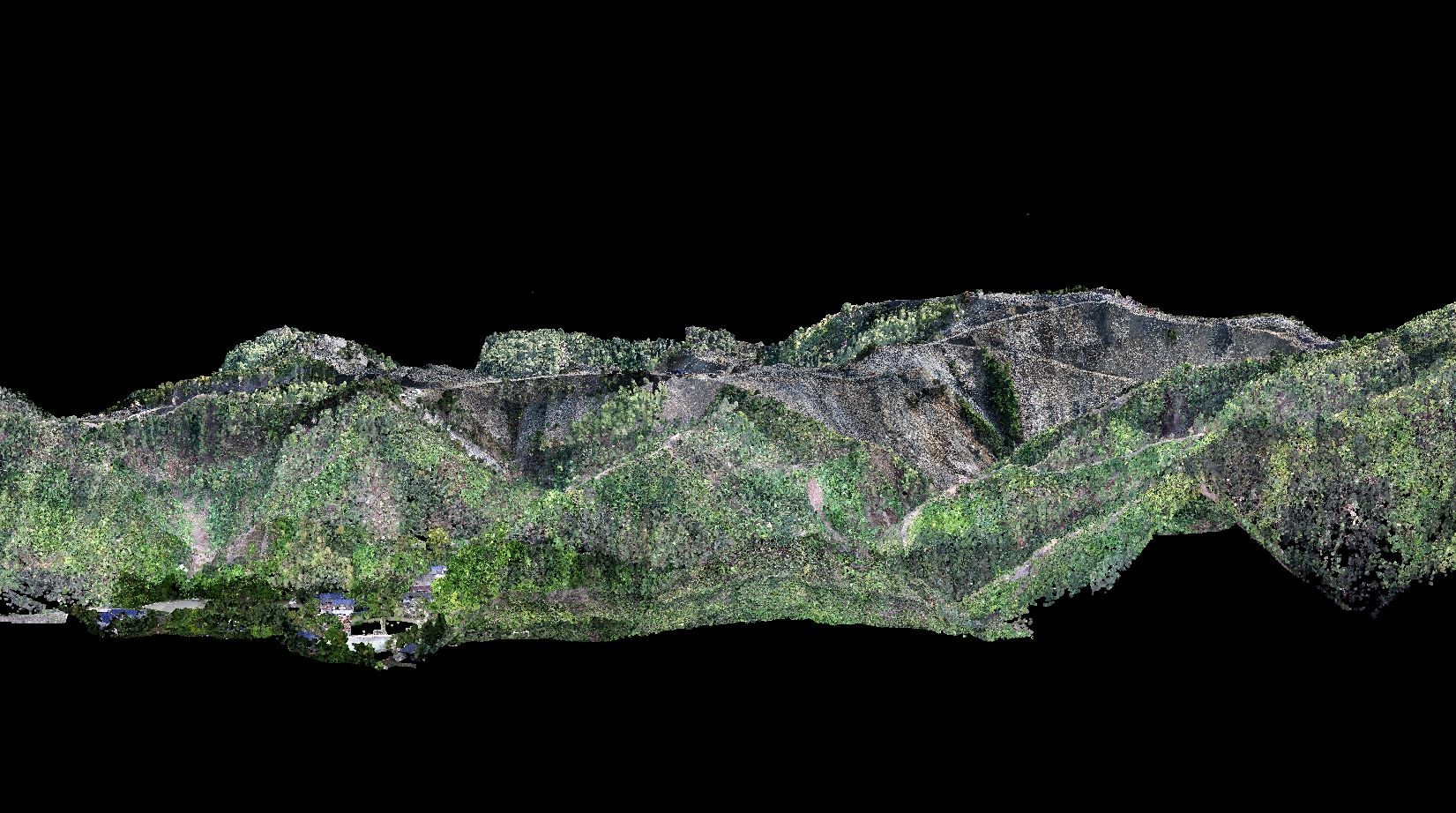
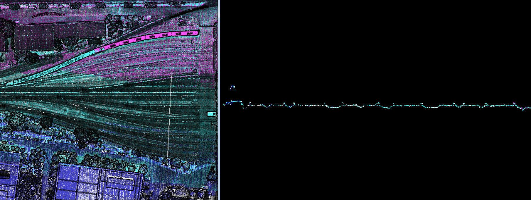
Application
Technical Parameter
| Standard payload (Kg) | 5 |
| Max. Payload (Kg) | 2.5 |
| Cruise speed (m/s) | 0-15 |
| MTOW (Kg) | 20 |
| Battery (V, mAh) | 14S 14000mAh × 1 |
| Working temperature | 20~45℃ |
| Wheelbase (mm) | 815 |
| Duration of flight (Minutes) | > 40 |
| Max. Duration (Minutes) | > 60 |
| Max. Fly height (m) | 5000 |
| Wind Resistance Wind Velocity | 6 |
| Differential mode Support | RTK/PPK |
| Package size (mm) | 663×496×338 |
Application for Mapping & Survey
Package Information


