

Active Member
|
[China]

Address: No.9-10, Jintai Building, Nanping Xi road, Nan'an Distract
Contact name:Silvia.Liu

Chongqing Gold Mechanical& Electrical Equipment Co.,Ltd |
|
|
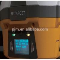
The V60 GNSS RTK GPS survey equipment system is designed to meet high quality standards at an affordable price. It is outstanding in it's class, with a rugged design and user-friendly functions.
*Main Specification of the V60 RTK GPS
---------------PERFORMANCE SPECIFICATIONS----------------------------------
***MEASUREMENTS***
• 220 Channels
• Advanced Pacific Crest Maxwell 6 Custom Survey GNSS Technology
• High precision multiple correlator for GNSS pseudo range measurements
• Unfiltered, unsmoothed pseudo range measurements data for low noise, low multipath error, low time domain correlation and high dynamic response
• Very low noise GNSS carrier phase measurements with <1 mm precision in a 1 Hz bandwidth
• Signal-to-Noise ratios reported in dB-Hz
• Proven Pacific Crest low elevation tracking technology
***Satellite signals tracked simultaneously***
GPS: Simultaneous L1C/A, L2C, L2E, L5
GLONASS: Simultaneous L1C/A, L1P, L2C/A (GLONASS M only), L2P
SBAS: Simultaneous L1 C/A, L5
Galileo: Simultaneous L1 BOC, E5A, E5B, E5AltBOC
BDS/Compass: B1, B2
QZSS: L1 C/A, L1 SAIF, L2C, L5
------------------------POSITIONING PERFORMANCE-----------------------------
***Static and Fast Static GNSS surveying***
Horizontal: 2.5mm+0.5ppm RMS
Vertical: 5mm+0.5ppm RMS
***Post Processing Kinematic***
(PPK / Stop & Go) GNSS surveying
Horizontal: 1cm+1ppm RMS
Vertical: 2.5cm+1ppm RMS
Initialization time: typically 10 minutes for base while 5 minutes for rover
Initialization reliability: typically > 99.9%
Real time Kinematic (RTK) surveying
Horizontal: 8mm+1ppm RMS
Vertical: 15mm+1ppm RMS
Initialization time: typically < 8 seconds
Initialization reliability: typically > 99.9%
Code Differential GNSS positioning
Horizontal: 25cm+1ppm RMS
Vertical: 50cm+1ppm RMS
SBAS: 0.50m Horizontal, 0.85m Vertical
--------------------------------------HARDWARE-----------------------------------
***Physical***
Dimensions (W x H): 18.20cm x 9.80cm (7.17 in x 3.86 in)
Weight: 1.25kg (2.76lb) without internal battery
Operating temperature: -45℃ to +65℃ (-49℉ to +149℉)
Storage temperature: -55℃ to +85℃ (-67℉ to +185℉)
Humidity: 100%, considering
Water/dustproof: IP67 dustproof, protected from temporary immersion to depth of 1m (3.28ft).
Shock and Vibration: Designed to survive a 3m (9.84ft) natural fall onto concrete.
***Electrical***
Power 6V to 28V DC external power input
Power consumption ≤3.5W
Automatic Switching between internal power and external power
Rechargeable, removable 7.4V, 5000mAh Lithium-Ion battery in internal battery compartment
***Internal battery life***
Static 13 - 15 hours
RTK Rover (UHF/GPRS/3G) 10 - 12 hours
RTK Base 8 - 10 hours
***I/O interface***
1 x Bluetooth
1 x standard USB2.0 port
1 x TNC UHF connector
2 x RS232 serial port
2 x DC power input (8-pin & 5-pin)
1 x Micro SD card port
--------------------------COMMUNICATION AND DATA STORAGE-----------------
***3G Communication***
Fully integrated, fully sealed internal 3G, compatible with GPRS
Network RTK (via CORS) range 20-50km
***HI-TARGET internal UHF radio (standard)***
Frequency: 450~470MHz with 116 channels
Transmitting Power: 1W, 2W, 5W adjustable
Transmitting Speed: 9.6Kbps, 19.2Kbps
Working Range: 5km typical, 8~10km optimal
***Pacific Crest internal UHF radio***
Frequency:

